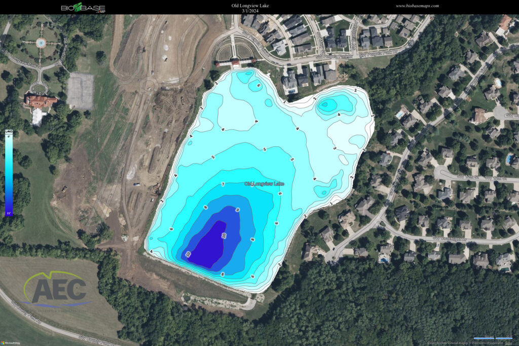
Having a bathymetric map of a pond offers numerous benefits to landowners. Firstly, it provides crucial information about the depth and topography of the pond’s bottom, helping landowners understand its overall shape and features. This knowledge is invaluable for planning and executing various activities such as dredging, shoreline stabilization, and habitat restoration.
Additionally, a bathymetric map allows landowners to make informed decisions regarding pond management. By identifying shallow areas prone to sediment buildup or deep spots with potential oxygen depletion, landowners can implement targeted interventions to maintain water quality and ecosystem health. This proactive approach can prevent issues such as algal blooms, fish kills, and habitat degradation.
Furthermore, bathymetric mapping enables landowners to maximize the recreational and aesthetic value of their pond. By understanding its underwater terrain, they can design fishing hotspots, swimming areas, and scenic viewpoints that enhance the overall enjoyment of the property. Moreover, accurate depth information helps ensure the safety of recreational activities by identifying potential hazards and shallow areas.
In summary, having a bathymetric map of a pond empowers landowners to effectively manage and optimize their aquatic resources. It provides valuable insights into the pond’s morphology, supports informed decision-making, and enhances the recreational and ecological value of the property.